


KC WD22 PCT2213, Jackson County, Missouri
About
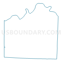
Outline

Summary
| Unique Area Identifier | 608206 |
| Name | KC WD22 PCT2213 |
| County | Jackson County |
| State | Missouri |
| Area (square miles) | 0.02 |
| Land Area (square miles) | 0.02 |
| Water Area (square miles) | 0.00 |
| % of Land Area | 100.00 |
| % of Water Area | 0.00 |
| Latitude of the Internal Point | 38.91992270 |
| Longtitude of the Internal Point | -94.60313730 |
Maps


Graphs
Select a template below for downloading or customizing gragh for KC WD22 PCT2213, Jackson County, Missouri


Neighbors
Neighoring Voting District (by Name) Neighboring Voting District on the Map
- KC WD22 PCT2203, Jackson County, MO
- KC WD22 PCT2204, Jackson County, MO
- KC WD22 PCT2205, Jackson County, MO
- Leawood 2-04 Voting District, Johnson County, KS
Top 10 Neighboring County Subdivision (by Population) Neighboring County Subdivision on the Map
Top 10 Neighboring Place (by Population) Neighboring Place on the Map
Top 10 Neighboring Unified School District (by Population) Neighboring Unified School District on the Map
- Blue Valley Unified School District 229, KS (114,021)
- Grandview C-4 School District, MO (31,917)
- Center 58 School District, MO (24,971)
Top 10 Neighboring State Legislative District Lower Chamber (by Population) Neighboring State Legislative District Lower Chamber on the Map
- State House District 46, MO (41,466)
- State House District 45, MO (33,550)
- State House District 28, KS (26,379)